RTK Centimeter-Level Positioning GNSS Module
Quad-band L1+L2+L5+E6 | RTK centimeter-level Accuracy | Raw Observation data output

Features At A Glance
The LG290P GNSS RTK Module is a quad-band, multi-constellation GNSS RTK module that supports the L1, L2, L5 and E6 frequency bands, compatible with GPS, BDS, GLONASS, Galileo, QZSS and NavIC satellite systems. Based on a high-performance GNSS SoC architecture, it integrates professional-grade interference detection and cancellation algorithm to effectively mitigate multiple narrow-band interferences, maintaining high sensitivity and strong anti-jamming performance even in complex electromagnetic environments. Through multi-frequency observations and RTK real-time differential algorithm, it significantly reduces multipath errors and enables centimetre-level high-precision positioning.
Small size with castellated holes design, it features a rich set of interfaces, and is easy to integrate, making it an ideal choice for high-precision navigation applications such as intelligent robots, precision agriculture, mining, surveying and mapping, and autonomous driving.
| Multi-constellation GNSS support including GPS / GLONASS / Galileo / BDS / QZSS / NavIC |
| Quad-band reception (L1 + L2 + L5 + E6) for higher positioning accuracy and stronger anti-interference performance |
| Centimeter-level RTK real-time differential positioning, with real-time status reporting of differential positioning |
| Castellated holes with immersion gold design, small size, easy to integrate into the device by soldering directly or inserting via the pin header |
| Onboard Type-C port supporting UART to USB communication and module power supply, enabling easy development and debugging |
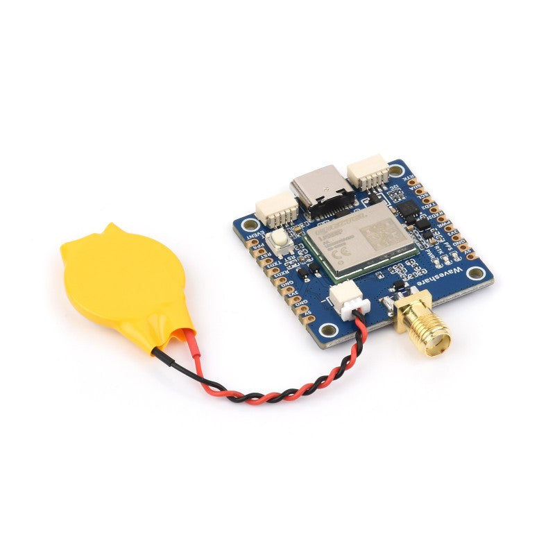
| Onboard 2-pin JST connector for connecting an RTC backup battery, effectively reducing Time to First Fix (TTFF) |
| Onboard 3 LED indicators for module operating status |
| Comes with online development resources and manual (examples for Raspberry Pi / Raspberry Pi Pico / Jetson Orin / ESP32 / Arduino) |
Specifications
| Product | LG290P GNSS RTK Module |
| Frequency Band | GPS: L1 C/A, L1C*, L5, L2C GLONASS: L1, L2 Galileo: E1, E5a, E5b, E6 BDS: B1I, B1C, B2a, B2b, B2I, B3I QZSS: L1 C/A, L1C*, L5, L2C, L6 NavIC: L5 SBAS: L1 |
| Number of Concurrent GNSS | 5 + QZSS |
| SBAS | WAAS, EGNOS, BDSBAS, MSAS, GAGAN, SDCM |
| RTK Function | RTK Rover and Base |
| Positioning Accuracy (PVT) | 0.7m CEP |
| Positioning Accuracy (RTK) | 0.8cm + 1ppm CEP |
| Navigation Update Rate | Default: 10Hz, Max: 20Hz |
| Velocity Accuracy | 0.03 m/s |
| PPS Accuracy | 5 ns |
| Communication Interface | USB, UART(4800~921600bps, 460800bps by default) |
| Protocol | NMEA 0183 / RTCM 3.x |
| Power Supply | 5V |
| Operating Temperature | -40 ~ 85°C |
| Dimensions | 33 × 33 mm |
Quad-Band L1 + L2 + L5 + E6 Positioning Technology
Supports simultaneous tracking of L1 + L2 + L5 + E6 multi-band satellite signals,
reducing multipath effects in urban canyons and improving positioning accuracy

RTK Mobile Station, RTK base station
Centimeter positioning
Two LG290P GNSS RTK Modules are used as an RTK Base Station and RTK Mobile Station respectively
By setting up continuous running reference stations on the ground known fixed coordinates using the L290P module which is configured in base station mode, or by paid RTK base station enhanced services, transmitting GNSS calibration value to L290P terminals which uploading rough positioning data, the terminals, with errors like multipath refraction, is able to calculate error value in real time, for centimeter-level positioning in seconds.

Concurrent Reception of Multi-GNSS Systems
Supports GPS, BDS, GLONASS, Galileo, QZSS, NavIC
and still retains low power consumption

Supports SBAS Augmentation Systems
It enables multi-satellite enhanced positioning and real-time error correction, significantly improving positioning accuracy and reliability in complex environments. This product supports WAAS, EGNOS, BDSBAS, MSAS, GAGAN, SDCM, and other augmentation systems

Small Size and Easy to Integrate
Castellated holes with immersion gold design, small size, easy to integrate into the device by soldering directly or inserting via the pin header

Compatible with Multiple Programming Platforms
Provides demos and user manuals for Raspberry Pi / Raspberry Pi Pico / Jetson Orin / ESP32 / Arduino, enabling easier development integration and strong scalability

Applications
Ideal choice for high-precision navigation applications such as intelligent robots, precision agriculture, mining, surveying and mapping, and autonomous driving, etc.

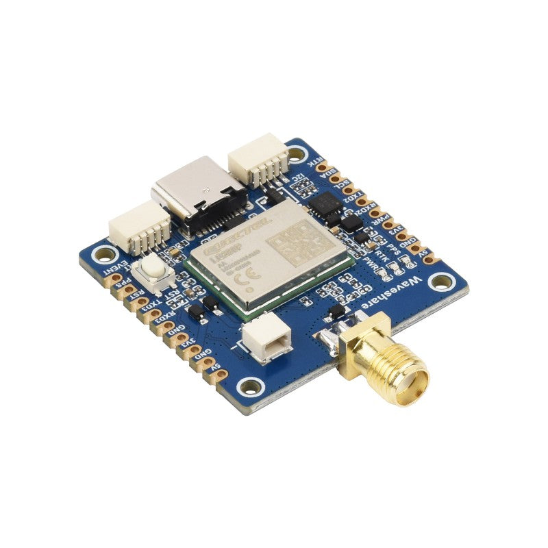
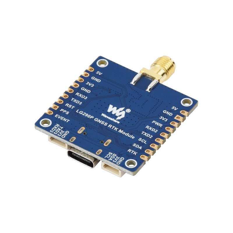
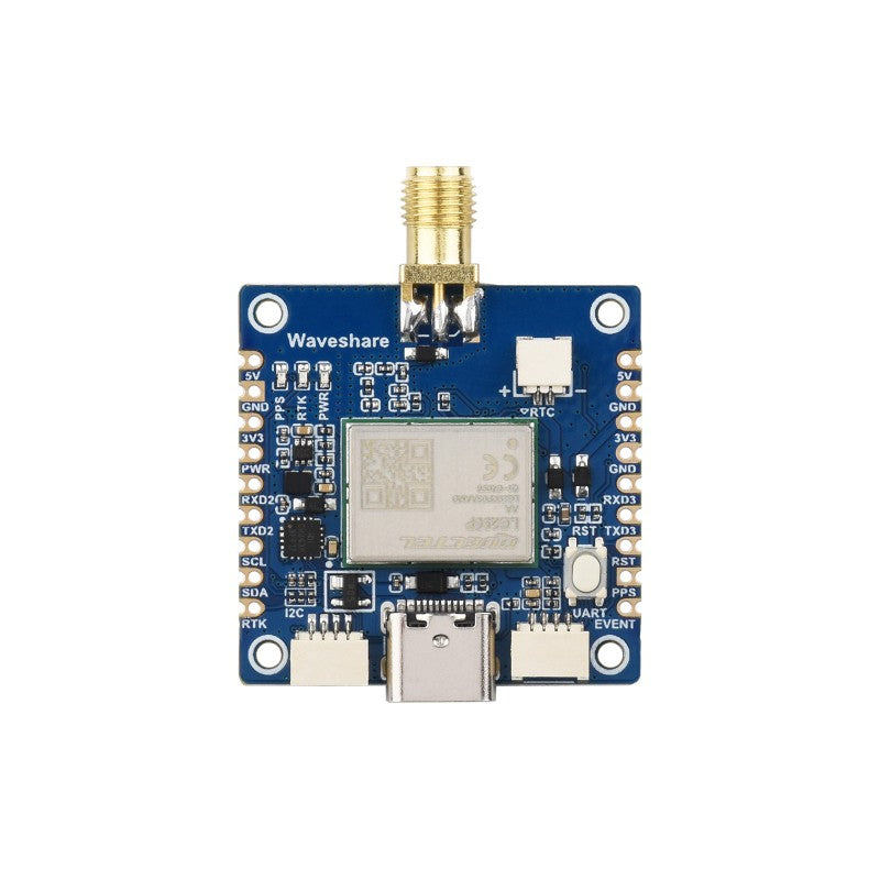
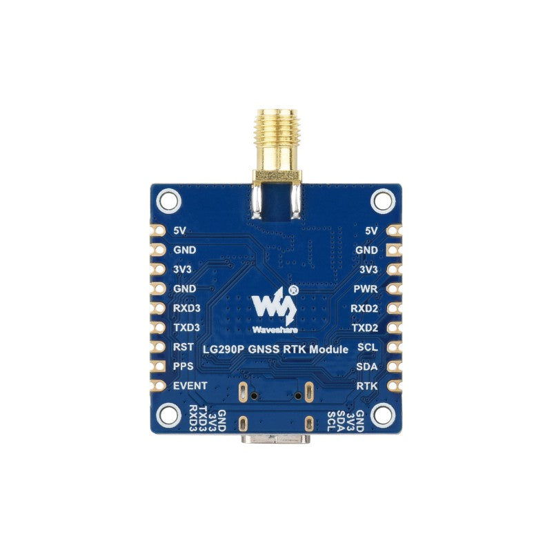
What's On Board

Pinout Definition

Hardware Connection Examples
Connects to a PC/Raspberry Pi/Jetson Orin series board via USB port

Connects to Raspberry Pi Pico via UART pins or UART SH1.0 4PIN header

Connects to ESP32 via UART pins or UART SH1.0 4PIN header

Product Show

Outline Dimensions

Resources & Services
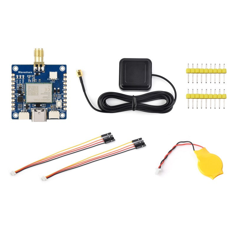
Package Content
Weight: 0.119 kg
LG290P GNSS RTK Module x1
Active GNSS positioning antenna x1
2.54mm pitch header x2
SH1.0 4PIN cable ~150mm x2
RTC batt. (2PIN JST connector) x1