
Choosing LiDAR for Drone Mapping: Your Complete Guide to Precision Aerial Surveying

The global LiDAR drone market is experiencing explosive growth, projected to reach USD 2,055.93 million by 2032 with a remarkable 25.20% CAGR. This surge reflects the transformative impact of choosing LiDAR for drone mapping across industries, from agriculture to construction. Whether you're a surveyor, construction manager, or GIS professional, selecting the right LiDAR system for your drone mapping projects can dramatically improve accuracy, efficiency, and cost-effectiveness.
Understanding LiDAR Technology for Drone Mapping
Light Detection and Ranging (LiDAR) technology revolutionizes aerial mapping by using laser pulses to create highly accurate 3D representations of terrain and structures. LiDAR refers to Light Detection and Ranging, a technology that uses laser pulses to create high-resolution 3D maps of the terrain and structures below. When integrated with drones, this technology offers unprecedented accessibility and precision for mapping applications.
The fundamental process involves emitting thousands of laser pulses per second toward the ground, measuring the time each pulse takes to return, and calculating precise distances. LiDAR is able to penetrate dense vegetation and reveal the true topography of the land beneath, making it superior to traditional photogrammetry in challenging environments.
Key Factors When Choosing LiDAR for Drone Mapping
Accuracy Requirements
Different LiDAR systems offer varying levels of precision. Wingtra LIDAR boasts a vertical accuracy of 3 cm (1.2 in), validated by leading customers as top-of-the-line from a flight height of 60 m (200 ft). For topographic mapping requiring 1:500 scale accuracy, TOPODRONE LiDAR scaners with high-precision IMU and multi-system L1/L2 GNSS receiver for aerial LiDAR survey and mapping with an 3-5 cm XYZ accuracy without using GCPs provide excellent performance.
Consider your project requirements:
-
Survey-grade accuracy (1-3 cm): Essential for engineering projects and detailed topographic mapping
-
Mapping-grade accuracy (5-10 cm): Suitable for forest management and general surveying
-
General accuracy (10+ cm): Adequate for large-area reconnaissance and preliminary surveys
Range and Coverage Capabilities
Modern LiDAR sensors offer impressive range capabilities. The Microdrones mdLiDAR1000 is an integrated drone solution designed for quick and efficient production of high-quality 3D point clouds. It pairs a robust md4-1000 UAV platform with a downward-oriented LiDAR sensor, providing up to 6 cm accuracy in real-world scenarios. For extended range applications, some systems can detect targets at distances exceeding 400 meters.
Point Density and Data Quality
Point density directly impacts the detail level of your 3D models. The JoLiDAR-120 offers impressive specs such as a 1430-meter measuring range, 1.8 million points/second maximum point frequency, and 15 maximum echo counts. Higher point densities provide more detailed terrain models but require greater processing power and storage capacity.
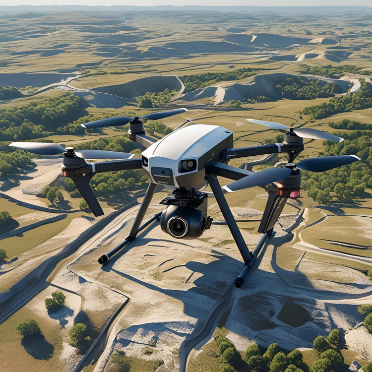
Top LiDAR Sensors for Drone Mapping in 2025
Professional-Grade Options
DJI Zenmuse L2: The L2 combines LiDAR and RGB imaging with a high-accuracy IMU and built-in GPS capabilities, making it perfect for mapping jobs that require very accurate readings. This integrated solution offers up to 450-meter detection range and seamless compatibility with DJI enterprise drones.
YellowScan Voyager: Equipped with a laser scanner with a 100° field of view and an acquisition rate of up to 2400 kHz, it offers optimal point density for demanding projects. This sensor excels in corridor mapping and infrastructure inspection applications.
GreenValley LiAir X3C-H: Weighing just 1.12 kg, it combines a Livox AVIA-based LiDAR sensor and a 26 MP camera, covering 360° horizontally and up to 40.3° vertically. Its lightweight design makes it ideal for extended flight missions.
Entry-Level Solutions
For budget-conscious operations, several manufacturers offer cost-effective LiDAR sensors that deliver solid performance for basic mapping applications. These systems typically provide 5-15 cm accuracy, sufficient for many surveying and monitoring tasks.
Drone Platform Considerations
Payload Capacity and Integration
The weight of the LiDAR for Drone hardware system is a constraint for any drone. If the drone is not able to lift the complete payload (LiDAR hardware, battery, mount, antenna, camera…), no flight and no acquisition possible! Calculate total payload weight including the LiDAR sensor, mounting hardware, and any additional cameras or sensors.
Flight Time and Coverage
Multirotor vs. Fixed-Wing: A multirotor will always have less autonomy than a fixed wing drone, which has the advantage of hovering and consuming less energy. Fixed-wing platforms like the eBee X with up to 90 minutes of flight time and exceptional endurance, this drone is an ideal choice for large-area surveys, including LiDAR mapping excel for extensive area coverage.
Weather Resistance
Professional mapping often requires operation in challenging conditions. Some models, like the DJI Matrice 300 RTK, offer weather resistance (IP45-rated), but extreme weather conditions like heavy rain or high winds can still affect performance.
Applications and Use Cases
Construction and Infrastructure
When developers are interested in a piece of land, understanding its topography is crucial for planning and budgeting. LiDAR allows them to see through dense vegetation and assess the land's contours and features. This capability enables accurate earthwork calculations and site preparation planning.
Environmental Monitoring
Monitoring the natural water cycle is vital in conservation and forestry, especially the context of a national park. High water levels in ponds and lakes can lead to overflow and unintended water drainage, potentially causing ecological disruption or flooding.
Corridor Mapping
Corridor mapping is one of the most significant applications of LiDAR drones, which has been substantially augmenting the growth of the market. During the planning and construction of infrastructure like roadways, railways, and oil and pipelines, corridor mapping is a critical step.
Cost Considerations and ROI
The LiDAR drone market reflects significant investment potential. The global LiDAR drone market size reached US$ 189.3 Million in 2023. Looking forward, IMARC Group expects the market to reach US$ 1,422.2 Million by 2032, exhibiting a growth rate (CAGR) of 25.12% during 2024-2032.
When budgeting for LiDAR drone mapping:
-
Initial hardware investment: $50,000-$300,000 for professional systems
-
Software licensing: $5,000-$25,000 annually
-
Training and certification: $2,000-$10,000 per operator
-
Maintenance and calibration: 5-10% of hardware cost annually
Calculate ROI by comparing traditional surveying costs against drone LiDAR efficiency gains. Mapping 160 acres used to take days—now, it's done in under an hour with pinpoint detail.
Integration and Data Processing
Software Compatibility
Choose LiDAR systems with robust software ecosystems. The CW-15 is its advanced point cloud processing software, which enhances data accuracy through automatic matching, segmentation, leveling, and more. Popular processing platforms include:
-
DJI Terra for integrated workflows
-
Pix4D for advanced photogrammetry integration
-
CloudCompare for open-source processing
-
TerraSolid for professional surveying
Data Management
LiDAR surveys generate massive datasets requiring efficient storage and processing infrastructure. Plan for cloud-based solutions or local high-performance computing resources to handle point cloud processing and analysis.
Future Trends and Considerations
The industry continues evolving rapidly. The development of 4D LiDAR sensors are expected to create significant growth opportunities during the forecast period. Emerging trends include:
-
AI-enhanced processing: Automated feature extraction and classification
-
Real-time processing: On-board data processing for immediate insights
-
Multi-sensor fusion: Integration with thermal, multispectral, and RGB sensors
-
Edge computing: Reduced data transfer requirements and faster results
Making Your Final Decision
Choosing LiDAR for drone mapping requires balancing accuracy requirements, budget constraints, and operational needs. Start by clearly defining your mapping objectives, required accuracy levels, and typical project sizes. Consider renting or leasing equipment initially to evaluate different systems before making major investments.
Professional training is crucial for maximizing system capabilities. While basic drone piloting skills are essential, additional training in LiDAR data processing is highly recommended to leverage the capabilities of the technology fully.
Conclusion
The decision of choosing LiDAR for drone mapping represents a significant opportunity to transform your surveying and mapping capabilities. With the market experiencing unprecedented growth and technology advancing rapidly, now is an ideal time to invest in LiDAR drone mapping solutions. Focus on accuracy requirements, payload compatibility, and long-term operational costs when making your selection.
Success with LiDAR drone mapping depends on matching the right technology to your specific applications. Whether you're conducting topographic surveys, infrastructure inspections, or environmental monitoring, the combination of appropriate LiDAR sensors and drone platforms can deliver exceptional value and competitive advantages in today's data-driven marketplace.
Frequently Asked Questions
Q: What's the difference between LiDAR and photogrammetry for drone mapping? A: LiDAR uses laser pulses to directly measure distances and can penetrate vegetation to reveal ground surfaces, while photogrammetry relies on overlapping photographs to create 3D models. LiDAR excels in forested areas and provides consistent accuracy regardless of lighting conditions, whereas photogrammetry is more cost-effective for large, open areas with good visibility.
Q: How do I determine the right LiDAR sensor range for my mapping projects? A: Sensor range should match your typical flight altitude and coverage requirements. For detailed surveys requiring high accuracy, fly lower (40-80m) with shorter-range sensors. For large-area mapping where efficiency is prioritized over extreme precision, higher altitudes (100-200m) with longer-range sensors are more suitable.
Q: What drone payload capacity do I need for professional LiDAR mapping? A: Professional LiDAR systems typically weigh 1-5 kg including mounting hardware. Add 0.5-1 kg for batteries and accessories. Choose drones with 20-30% more payload capacity than your calculated requirements to ensure stable flight performance and accommodate future sensor upgrades.
Q: How much data storage is required for LiDAR drone mapping projects? A: LiDAR surveys generate 1-10 GB of raw data per square kilometer depending on point density and flight parameters. Factor in processed data, backups, and project archives when planning storage infrastructure. Cloud-based solutions often provide cost-effective scalability for varying project sizes.
Q: What certification or training is required for commercial LiDAR drone mapping? A: Beyond standard Part 107 commercial drone certification, LiDAR operators benefit from specialized training in data processing software, survey principles, and point cloud analysis. Many manufacturers offer certification programs, and professional surveying organizations provide relevant continuing education courses.